| |
| Winchester Five Peaks Community Challenge |
| Wales |
| Test Way |
| Clarendon Way |
| Monarch's Way |
| South Downs Way |
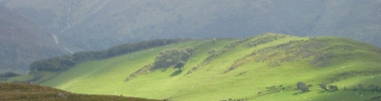
| Farley Mount |
| Other Hampshire Walks |
| Misc Walks |
| My Inheritance Walks |
For years I was a dedicated fan of John Peel's Home Truths programme on Radio 4, and after both John's and the programmes sad demise, I eventually forgave Fi Glover for not being John, and Saturday Live for not being Home Truths, and transferred my allegiance. A regular feature on Saturday Live is the Inheritance Tracks of various celebrities. Now, music has not been a major influence in my life, but I have come to love walking, and I have my favourite spots in the world. I didn't really inherit any walks ... neither of my parents were into walking as a passtime, but recently my daughter has become a walking afficionado, and I thought I would like to record my favourite walks for her ... and for any other members of my family and friends who might be interested. So here they are; James Hardiman's Inheritance Walks. Maybe one day I'll do "grandpa walks" with Gabriel, and any other grandchildren I may have by then! As of today (7th August 2009), this project has only just begun. If you click on a link and nothing happens, it's because I haven't done that bit yet. Keep coming back; the project will gradually grow. 16th August: I now have an Inheritance Walks blog, which will be a diary of the various walks, as they happen. 10th August: The Test Way section is complete (but will be updated as we walk the various routes). September 27th: We have enrolled on the Walk the Test Way sponsored Walk on October 11th. Sponsor James, supporting the Red & White appeal. Sponsor Susan, supporting the Helen Bamber Foundation. |
The Walks In October 2009, after five months of serious dieting, and serious training (mostly on the Test Way) I returned to Wales to see what I could do. I'm writing this sitting in a Welsh cottage, watching (hopefullly) the rain clear up the valley, and ginerly testing my sprained ankle. Hopefully both will improve enough for me to get up Cadair Idris today. Geocaching Hashing GPS The global positioning system has helped my navigation a lot recently, and Geocaching is almost impossible without one. I use the fabulous UK-made SatMap Active 10, and all the GPX routes available on this website were produced using the SatMap online route planner, and are available on the SatMap Route Share system.
I have used the amazing Geograph project (photographing every grid square in the UK) to illustrate a lot of these walks. As you do the walks, you might like to contribute your own pictures to Geograph. If we ever find our camera, we may do the same. |